


How to find your way to, and around, the Monikie, Scotland area.
(A page of maps and photographs and links to mapping
websites, please wait.)
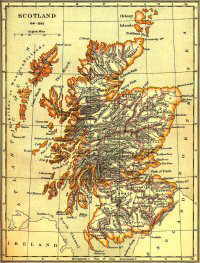
Scotland 1641 - 1892
The villages of Monikie (pronounced "MON-EE-KEE") and Newbigging
about two miles to the South,
and the surrounding area form a lovely rural setting about 11 miles north-east of
Dundee, Scotland's fourth largest city. The area is
situated almost in the centre of a triangle formed by the ancient former burghs of Dundee,
Arbroath and Forfar. We are very near to Carnoustie and many other world famous
golf courses.
Monikie is well known for its excellent facilities - please
checkout the links, or use our Site
Search Engine - take your time - there's plenty to see!
 You can see/print
a timetable
of services to/from Monikie and district, in PDF format HERE.
You can see/print
a timetable
of services to/from Monikie and district, in PDF format HERE.
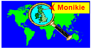
You are welcome to visit MONIKIE in person (click the
local business button above for accommodation) and the following
maps will help you find your way there.
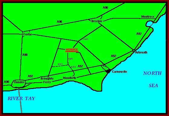
(Original base version of this image produced from the Ordnance Survey Get-a-map
service. Image reproduced with kind permission of Ordnance
Survey and Ordnance Survey of Northern
Ireland)
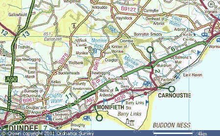
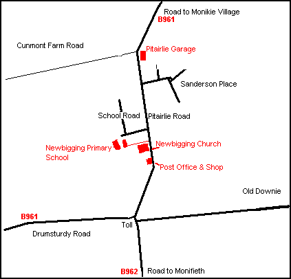
Find the 'hotspots' (red) on the two village maps below
which are of interest to you for further link/s.
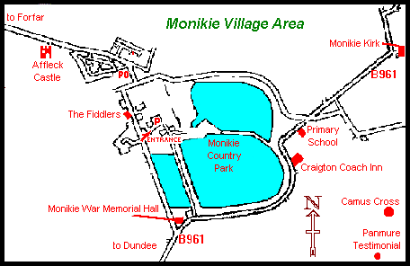
Satellite view of Monikie
Village, Craigton of Monikie, Kirkton of Monikie and nearby.
Please reload this page
if all maps do not appear.
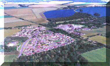
For much larger versions of the aerial photographs below please click on the small
version.
There you can find the 'hotspots' for even more photographs!
|
Taken from above
Affleck Castle looking south-east over Monikie Village towards Monikie Country
Park, also Craigton and Kirkton of Monikie.
|
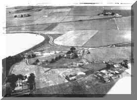
Taken in 1953 from above the Panmure Testimonial, looking
northwards over Craigton of Monikie towards East and West Hillhead Farms.
|
 |
 |
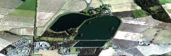
Below - 'Flying' towards Monikie Country
Park, the former reservoirs can be clearly seen.
The colour photograph above was taken from a position to the North (lower left)
of that below,
whereas the monochrome photograph was taken from the South (top right) of the
one below.
Please reload this page
if all maps do not appear.
Try this mapping site - good detail - http://uk2.multimap.com/
Look for postcode DD5 3QA
To help you find your way around this area here
is an old sketch map (326k) of Angus and Kincardineshire
showing parish and some place names, . . .
. . .or you could link here to the GENUKI interactive
parish map of ANGUS which shows reference codes and links to parish webpages
and neighbouring former counties.
For more golfing and other information about this part of Eastern Scotland check-out
the tourism pages.
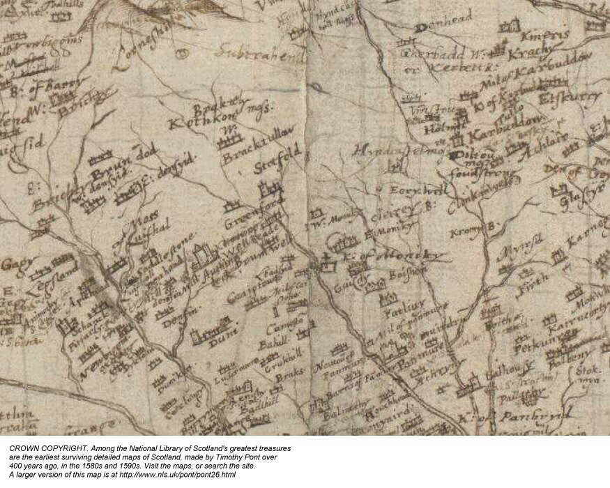
The following section from a very old map is well worth a look
to see if you can find place names which are there today, but with very different
spelling. Look for "K. of Moniky" - Kirkton of Monikie (with the
kirk graphic alongside); "Kromy B." - Crombie Burn: "Krachy"
- Craichie; - "Craigtoun, Brumwell and Auchin..." Castle can be seen
centrally. "Newbiggin" can be seen to the lower left.
The map is lying more on a NE to SW axis or even more so (than the normal N - S
axis) and it is obviously not an accurate representation as on maps of
today. this makes it more 'fun' to find the places!
You are strongly advised to visit the National Library of Scotland website of
origin at www.nls.uk/pont for other Pont
maps, and lots else besides about Scotland.
Please reload this page
if all maps do not appear.
 |
A selected area of Ainslie's 1788 map of the Monikie Parish and
parts of adjoining parishes. Be warned that this graphic file is VERY
LARGE (1269 kb.) and can take quite a while to download - it is worth the
wait. The map can be enlarged to view at higher resolution for clarity and
better detail. A copy of the complete full-scale original map can be found
in Montrose Library, Angus, Scotland (and elsewhere). Click the image
alongside to download the map.
|
LOCAL INTEREST ¤
FAMILY HISTORY INTEREST ¤
NEWBIGGING INTEREST ¤
ARLENE'S LISTS ¤
LOCAL BUSINESS ¤
'DOWN THE AGES'
CHURCH PAGES ¤
CHURCH MAGAZINE ¤
OLD BOOK EXTRACTS ¤
STIRLING SURNAME ¤
MONIKIE MEMORIAL HALL ¤
'THE MONIKIE STORY'
WEB PAGES LIST ¤
SEARCH THIS WEBSITE ¤
HOMEPAGE ¤
CONTACT & EMAIL
Please press the BACK BUTTON for your previous page.
This page was updated - 09 December, 2014

